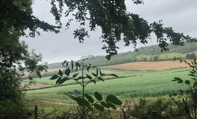
如果你喜欢户外运动,避开阴雨连绵潮湿阴暗的秋冬季节,夏日的吉尔福德周边及萨里郡绝对是一个野外徒步的理想之地。首先,起起伏伏的地形能够使你在高出轻而易举获得一大片宽广的视野,轮作农地、草地、林地、花圃、乡间别墅等错落有致,仿佛被精准地镶嵌一副田间油画之中;其次,萨里郡靠近伦敦都会区,城镇稠密,基础设施便利,基本所有的小镇乡村都有沥青路网连接,所有的景点、郊野公园和保护区都由铺砌完善的人行步道和骑行道连接,所以很多即使位置很偏僻的自然保护区也有着很高的可抵达度。同时这里城镇密集,基本不出几里地就有一片居民区,当你徒步或骑行觉得疲倦需要休息进食时,很容易找到小型商超或小卖部;最重要的一点是,在郊野徒步可以近距离沉浸式体会英伦乡村风情。我个人认为,英国真正的风情,不在于伦敦、曼城这样大都会的繁华,而在于乡村的静谧,英伦乡村承载着太多文学作品里的经典场景,承载着这个国家国民太多的共同而古老的记忆。也许在行进中,你会发现一些古老的、充满异域风情、装饰考究的餐厅或小酒馆,进去体验一番,也不妨是对徒步所产生疲劳的一种犒赏吧。
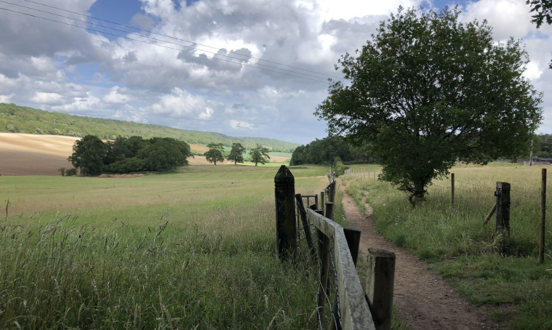
就目前我的个人经历而言,我认为吉尔福德周边最佳的徒步路线因该是位于城镇东南奥尔伯里Albury旁Tillingbourne河流经的一片区域,它属于萨里山自然风景区Surrey Hill AONB的一部分。整体来说,这条徒步线路距离适宜,地形起伏但高差不大,体能中等者均可体验。许多年前开始,萨里郡治就在这里规划了一套专门的徒步线路 Tillingbourne at work,从奇尔沃思站(Chilworth Station)开始,经过农田,林地和郊野公园。该路线需要横穿Tillingbourne河,该河曾经为该地区的许多面粉厂、粉末研磨厂,造纸厂和玉米加工厂提供水力动力。这条线路有一部分是沿着古老的从温彻斯特到坎特伯雷的朝圣者之路规划的。
徒步步道有几部分构成,包括一些低缓的斜坡以及几个略微陡点的部分,在下雨天时,低地水位上涨,所以穿过林地和农田的路径可能会变得很泥泞,因此尽量避免这个时候前往,如果前去,需要准备结实的户外防滑鞋。在徒步过程中,需要穿过一些私人牧场,可以通过旋转门(亲吻之门)。最有趣的就是穿越牧场时和牛群及驯马相遇了,这些动物都很温顺,但最好还是保持一个安全距离。
This walk path is designed through a collaboration with the Surrey County Council, which is an undulating walk within the Surrey Hills AONB zone, starting from Chilworth Station and passing through farmland, woodland and parkland. The route crosses the Tillingbourne stream, which used to power a number of powder, paper and corn mills in the area. Part of the walk follows the Pilgrims Way, running from Winchester to Canterbury. There is also a shorter variation of this trail that can be taken. The walk has several steady slopes plus a couple of steeper sections. The paths across woodland and farmland can get quite muddy so stout shoes or boots are required and wellingtons are recommended in the winter months. You will need to negotiate a number of kissing gates plus 9 stiles (all of which have open fence surrounds which will be suitable for most dogs to pass through). The most interesting part of the journey is you probably will be going through a few of the farm fields with horses and cattle, these animals are generally very mild but bear in mind that don’t move very close to them and maintain a safety distance. You will need to cross the railway at an unsignalled footpath crossing so take extreme care and listen carefully for trains before you cross. If you are looking for refreshments there are several options. The Percy Arms pub is at the start of the walk, opposite Chilworth Station, and the William IV pub is in Little London, 5 minutes walk south of Waypoint 4. There are a number of pubs, cafes and shops in the village of Shere, a short walk from Waypoint 5. Ordnance Survey Map: Explorer 145 Guildford and Farnham. This walk follows public rights of way which cross private and public land. Information is included for your interest, but please respect people’s privacy, keep dogs under control and remember the Countryside Code.
这条徒步路线的重点和主题都是围绕着蒂林伯恩河Tillingbourne进行的,这条河流沿着北山的南侧延伸,然后与流经吉尔福德的韦河汇合。我们萨里大学的主校区里,Surrey Court宿舍区的一栋楼就是以Tillingbourne来命名的。这条河发源于Leith Hill北部的Tilling Springs附近,并且穿过星期五街,阿宾格·哈默(Abinger Hammer),戈姆斯霍尔(Gomshall),谢尔(Shere),奥尔伯里(Albury),切尔沃思(Chilworth)和希尔福德(Shalford)。源头的Tilling Springs是自然保护区人烟稀疏。
The River Tillingbourne (also known as the Tilling Bourne) runs along the south side of the North Downs and joins the River Wey at Guildford. It worth mentioning that there’s one building within the Surrey court accommodation area of our main campus is named by this river, Tillingbourne. Its source is near Tilling Springs to the north of Leith Hill and then flows through Friday Street, then Abinger Hammer, Gomshall, Shere, Albury, Chilworth and Shalford. The source area Tilling Springs is basically a semi-natural uninhabited area.
蒂林伯恩最初沿一系列的圩堰和小瀑布向北流经莱斯山北侧,然后通过Abinger Hammer和Chilworth然后向西行,经过沙尔福德后和韦河River Wey交汇。英格兰南部的软岩层分布规律与延伸方向基本决定了这边的河流走向,英国气候多雨潮湿,所以这边河流水量充沛,不存在枯水期一说。
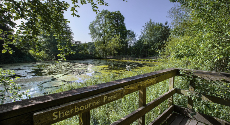
The Tillingbourne initially flows northward for 4 km (2.5 mi) down the northern slopes of Leith Hill over a series of weirs and cascades, before turning west to run for 14 km (8.7 mi) through Abinger Hammer and Chilworth towards the River Wey at Shalford. The Tillingbourne river has four principal tributaries, namely, the Friday Street stream joins at Wotton House; the Holmbury St Mary stream joins at Abinger Hammer; the Sherbourne Brook drains the Silent Pool and Sherbourne Pond and the Law Brook joins near Postford. The river is classified as a subsequent stream, since its course is determined by the direction of the stratum of softer rock for the majority of its length.
从17世纪到20世纪中叶,蒂林伯恩山谷(Tillingbourne valley)是主要的工业区,因为它靠近伦敦,并且通过韦河以及运河连同伦敦泰晤士河,交通非常便利。这条河曾被用来为该地区的大量工厂提供动力。沿河道已确定了约24个工厂,用于火药,钞票造纸,炼铁,制线,装满,鞣革和抽水等多种行业,以及更常规的行业面粉,麦芽粉和麦芽粉。所以沿着Tillingbourne河至今你能够看到许许多多水力磨坊遗存,目前这些磨坊已经被很好保护起来,有些成为了旅游景点,比如Brookmill,Wotton House Mill和Abinger Hammer Mill。同时,这里的一些沿河作坊甚至能够制造火药,最早的火药厂是就1626年由希尔斯沃思的东印度公司建立的。
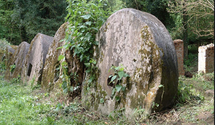
From the 17th to the mid 20th centuries the Tillingbourne valley was a major industrial area due to its closeness to London and the ease of transport via the Wey river, canal and their connection with Thames in London. The river was used to power a relatively large number of mills in the area. Some 24 mill sites have been identified along the course of the river, used for such diverse industries as gunpowder, paper making for bank-notes, iron-working, wire-making, fulling, tanning and pumping water, as well as the more conventional flour, grist and malt milling. Therefore, there are lots of mills you can see along the Tillingbourne river. Nowadays, many of those have been placed under good protection and being a part of local tourism plan. Some of the earliest gunpowder mills were those set up in 1626 by The East India Company at Chilworth.
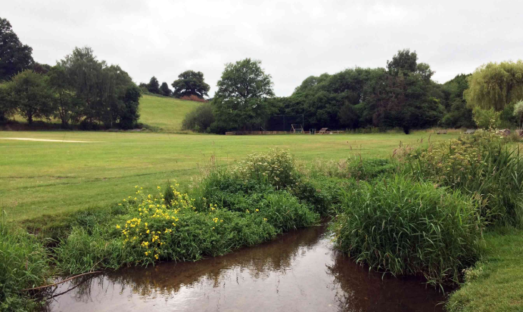
经过多年的治理、去工业化和去除污染的努力,蒂林伯恩河Tillingbourne清澈洁净,在水流平缓的汇集区,鱼类丰富,既有野生鳟鱼又有粗鱼的鱼类种群。环境署一直在与当地渔民合作,通过重新建立池塘和浅滩的栖息地并减少悬垂的植被来改善这些鱼类的栖息地。同时河流也是让附近学生亲近自然、了解认识自然的一个天然工具,河流及其周围地区经常由附近的实地研究中心学生进行研究。
The River Tillingbourne supports a fish population of both wild brown trout and coarse fish. The Environment Agency has been working with local fishermen to improve the habitat for these fish by recreating a pool and riffle habitat and by cutting back overhanging vegetation. The signal crayfish is a recent invasive species. The river and its environs are often studied by students from nearby field research centres.