
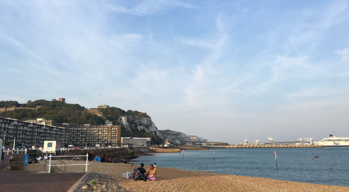
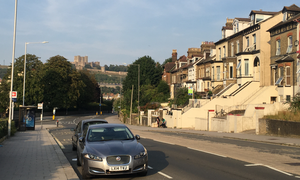
在结束坎特伯雷的旅行后,我继续乘坐近一个小时的火车到达了英国最东南的海港城-多弗尔Dover。这里最吸引我的便是连绵不绝的白崖,山崖上的城堡,以及联通英国和欧洲大陆的海港。很可惜由于时间缘故,在我来到多弗尔时,城堡的关闭时间将到,所以我只能沿着海滨大道走上白崖,欣赏迷人的海港风情。
After the trip to Canterbury, I continued to take the train for nearly an hour to Dover, the most southeast harbor city in the UK. What attracts me most here are the endless white cliffs, the castles on the cliffs, and the harbor that connects Britain and the European continent. It is a pity that due to time when I came to Dover, the closing time of the castle was approaching, so I could only walk up the white cliffs along the promenade to enjoy the charming harbor view.
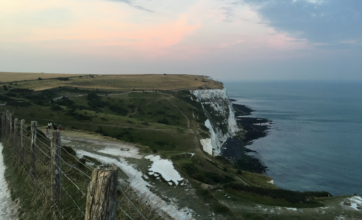
如今的多弗尔白崖被改造成了自然保护区,由英国国家信托基金National Trust来运营管理。白崖构成了英国东南海岸线的主要景观,从布莱顿、伊斯特本、黑斯廷斯一直向东延伸到福克斯通,多弗尔,直至拉姆斯盖特。崖壁上面的雷达站至今仍然为军方服务发挥着作用。在我来的这天,非常幸运,天空经常出现二战时英国空军使用的”喷火“式战斗机,我其实很好奇这些旧式飞机是如何维护保养到现在的。
Today, the White Cliffs of Dover have been transformed into a nature reserve, which is operated and managed by the National Trust. The white cliffs constitute the main landscape of the British southeast coastline, extending eastward from Brighton, Eastbourne, and Hastings to Folkestone, Dover, and Ramsgate. The radar station on the cliff still serves the military service today. On the day I came, I was very lucky to see that the Spitfire fighters once used by the British Air Force during World War II often appeared in the sky. I am actually very curious about how these old aircraft have been maintained in good conditions until now.
多弗尔是英伦三岛距离欧洲大陆最近的城镇,和对岸的法国加莱隔着一条浅浅的英吉利海峡(相距仅不到40km)。这本是一个平淡无奇的小城,由于在二战中的敦刻尔克大撤退和1944盟军D-Day诺曼底登陆行动的留名青史。二战初期,德国空军对英国实施大规模空袭,多弗尔就被设立为了前线防空情报站,人类最早的对空探索雷达就设置在这里。由于战争消耗,男丁不足,许多女性第一次以军人身份踏上工作岗位,在这里的无线电监听站工作,监听德军动向。
Dover is the closest town in the British Isles to the European continent. It is separated from the French Calais by a shallow English Channel (less than 40km). This is a rather ordinary town, due to the Dunkirk retreat in World War II and the 1944 Allied D-Day landing operation in Normandy. In the early days of World War II, the Luftwaffe carried out a large-scale air raid on the United Kingdom. Dover was set up as a front-line air defense intelligence station. The earliest air exploration radar of mankind was installed here. Due to the exhaustion of the war and the shortage of men, many women set foot on their jobs as soldiers for the first time, working at the radio monitoring station here to monitor the movements of the German army.
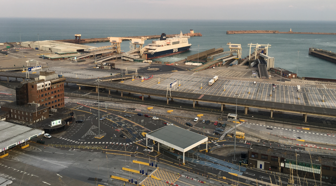
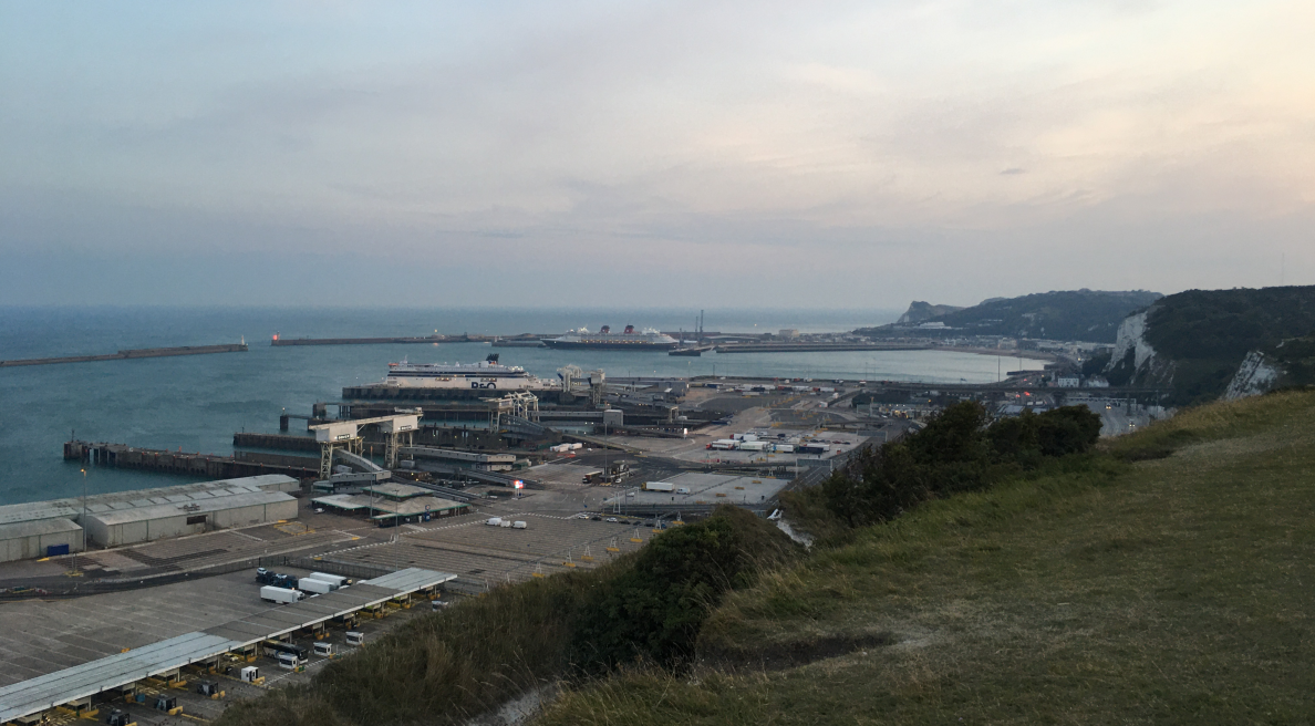
由于其独特的地理位置,后来被发展成为连接欧洲大陆地主要轮渡港口,崖壁下的海岸被填海造陆形成了一大片避风港区,外面有一大圈防波堤保护。所有来往两岸的货车在这里装载或驶出,奔赴各地的物流目的地。当然英国是右舵驾车,和欧洲其他国家并不相同,所以货车驶出轮渡时,要在港区进行反向换道,很像我们中国联通深圳和香港的罗湖、福田、深圳湾等口岸。
Due to its unique geographic location, it was later developed into a major ferry port connecting the European continent. The coast under the cliff was reclaimed from the sea to form a large sheltered area, and a large circle of breakwaters protected it. All trucks traveling between the two sides of the strait are loaded or driven out here and go to various logistics destinations. Of course, the United Kingdom drives a right-hand drive, which is different from other European countries. Therefore, when trucks leave the ferry, they must reverse lanes in the port area, which is pretty much like the Luohu, Futian, and Shenzhen Bay ports used to connect Shenzhen and Hong Kong in China.
后来英国和欧盟国家一起出资修建了连接两地的海底隧道,欧洲之星列车就在这条道路隧道上运行,从伦敦圣潘克拉斯火车站向西南方向一直驶去,在多弗尔进入下沉隧道,穿过海峡,并最终到达大海另一端的法国巴黎北站和比利时安特卫普火车站。
Later, the United Kingdom and European Union countries jointly funded the construction of an undersea tunnel connecting the two places. The Eurostar train runs on this road tunnel, going southwest from London St. Pancras Railway Station, and sinking through the tunnel from Dover, passing through the strait, and finally reaching the Paris North Station in France and Antwerp Railway Station in Belgium at the other end of the sea.
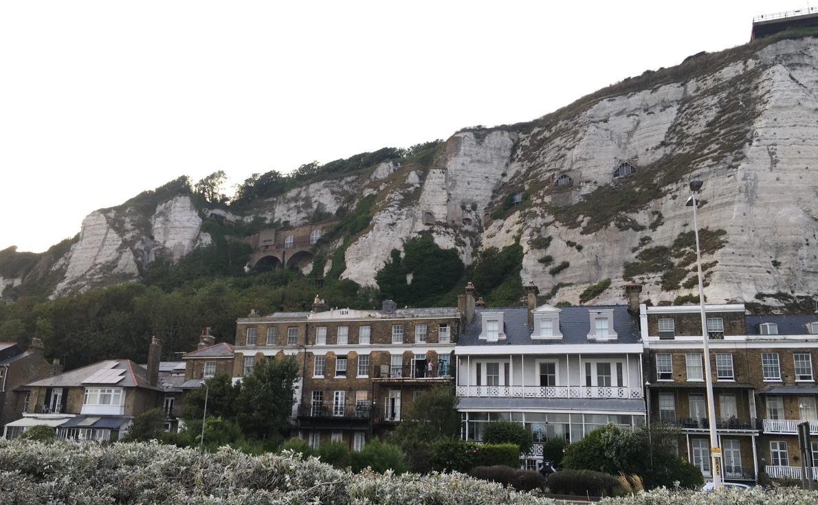
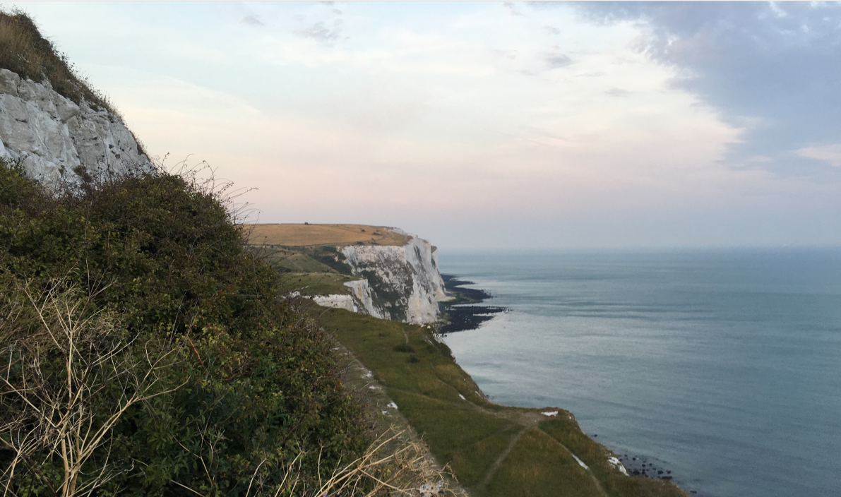
英国东南的地层有大量相对松散的白垩纪岩层分布,在亿万年的冰河期穿凿、风蚀河海浪拍击作用下,边缘岩层塌陷脱落,逐步就形成了英国东南海岸连绵不绝白崖,这也成了英国的重要标志。坐船从海峡另一头过来,最先看到的,就是那一线长长的白崖。一战和二战中,数百万英国军人远征欧陆,在无数留存下的日记手札中,这片白崖也成为了他们对家乡思念之情的重要一部分。
There are a large number of relatively loose Cretaceous rock formations in the southeastern United Kingdom. Under the action of hundreds of millions of years of glacial penetration and wind-eroded river waves, the edge rock formations collapsed and fell off, gradually forming endless white cliffs on the southeast coast of the United Kingdom. It has also become an important symbol of Britain. Coming over from the other side of the strait by boat, the first thing I saw was the long line of white cliffs. During World War I and World War II, millions of British soldiers expeditions to Europe. In countless diary notes left over, this white cliff has also become an important part of their nostalgia for their hometown.
多弗尔海角,与另一头的法国加来隔海对望。无尽的洋面,蔚蓝的海岸,汹涌的北大西洋波涛,承载了多少航海爱好者的迷思。俯瞰繁忙的多弗尔渡轮港,受疫情影响,货运卡车来往稀疏。
Cape Dover, across the sea from Calais, France. The endless oceans, blue coasts, and turbulent North Atlantic waves bear the myth of how many sailing enthusiasts. Overlooking the busy Dover Ferry Port. Affected by the epidemic, freight trucks are sparse